
Frenchtown Township Neighbors by Block
One address can be expanded into a careful block picture with several separate sources. The county map establishes physical adjacency. BS&A supplies tax-roll detail for a selected parcel. A public voter-file request is jurisdiction-based and contains protected-field limits. Old reverse directories and local organizations provide historical or community context, not a roster of every current household.
| Source | What It Shows About a Block | Access |
|---|---|---|
| Monroe County GIS parcel map | Adjacent parcels, roads, district context, and parcel geometry | Public interactive viewer, not a legal survey |
| Frenchtown BS&A | Tax-roll owner, parcel, situs and mailing details | Public municipal search; assessor fallback |
| Public QVF request | Allowed registration fields for a defined jurisdiction | Michigan request route with redactions |
| Deed and plat records | Recorded transfers and lot or private-claim geometry | Name index, counter, or archive route |
| Resort District contacts | Named beach or subdivision organization contacts | Public contact inventory, not membership list |
| Bresser and Polk directories | Past address-to-household or street listings | Library/catalog research |
Owner, voter, and occupant are three different record categories. A tax bill can go to an estate, company, trustee, or seasonal owner. A voter result does not list children, every adult, or protected people. Parcel lines show land, not social relationships. That distinction keeps a Frenchtown Township neighbors search useful without overstating what public records can prove.
Map a Frenchtown Township Parcel First
The Monroe County Interactive Parcel Map is the first tool for a block. Search or navigate to the address, select its parcel polygon, and preserve the parcel identifier, situs, and legal description. Then pan along the road and click the parcels sharing a boundary, facing the same segment, or otherwise belonging in the defined block.
The map’s own notice matters: its boundaries are not legal boundary determinations. County linework is exported from the real-property database and assessment details are maintained by town assessors. A river, railroad, road, or lot configuration can make visual closeness misleading. Confirm the relationship with the parcel map and, when needed, a plat or the Frenchtown assessor.
Start with the county parcel viewer to see the block in context.
The selected-parcel view helps distinguish true shared boundaries from nearby lots on a different road or in a different jurisdiction.
Mapping a Frenchtown Township Block
A reproducible block lookup records the geometry before names. State the street segment or parcel radius, access date, and map scale. From there, tax-roll and deed information can be kept in separate columns from a historic directory or association contact. That keeps a current map from being combined with an old listing as though they were the same date.
- Find the known address in GIS and record its parcel ID, situs address, and legal description.
- Select parcels that share a boundary or face the same defined road segment, then verify the relationship against a plat if the layout is unclear.
- Open each parcel in Frenchtown BS&A Online and label the tax-roll owner, mailing address, and situs address separately.
- Use the Register of Deeds only after obtaining the owner name. Its index is grantor-grantee based, not searchable by street address.
- Use a lawful QVF route or historical directory only for the specific question it can answer, with the record date noted.
A complete road-by-road chain belongs in the Frenchtown Township street directory; the block method stays focused on the immediate map relationship.
Frenchtown Township Owner and Voter Records
BS&A accepts Address, Name, and Parcel Number searches and advertises assessment, current tax, property-sale, building, and special-assessment modules. Its parcel details can include owner name, situs address, mailing address, legal description, values, and a principal-residence-exemption flag. A PRE is a tax classification and may support owner-occupancy research, but it does not identify all people who live at the address.
Michigan’s Voter Information Center is a personal-record tool. A broader public Qualified Voter File request can be made by a selected county, township, precinct, school, or other stated geography. Public records can include name, address, year of birth, registration date, status, voter ID, and requested history. MCL 168.509gg excludes phone, email, month and day of birth, signatures, identity-number fields, and Address Confidentiality Program applications.
Note: A public registration result can support a date-specific residence check, but it does not establish ownership or continuous occupancy.
Frenchtown Township Beach Community Contacts
Lake and beach subdivisions add a real community layer to the parcel record. The Frenchtown Resort District association inventory lists public contacts for several organizations. These are points of contact for association business, drainage, streets, lighting, or local community questions. They are not public membership rolls and should never be used to infer that a particular person owns or lives in a subdivision.
| Association area | What the public inventory supports |
|---|---|
| Baycrest Beach, Brest Bay Grove, Detroit Beach, and Erie Shores | Named association contact layer for waterfront communities |
| Grand Beach, Indian Trails, Woodland Beach, and Pointe Aux Peaux Farms | Organization contacts, subject to current association verification |
| Stony Pointe Beach, Stony Pointe Peninsula, and Long's Association | Community reference point, not a household directory |
| State Park Subdivision | The Resort District says it has contacts but no association |
Open the Resort District association page for current contacts and its specific subdivision notes.
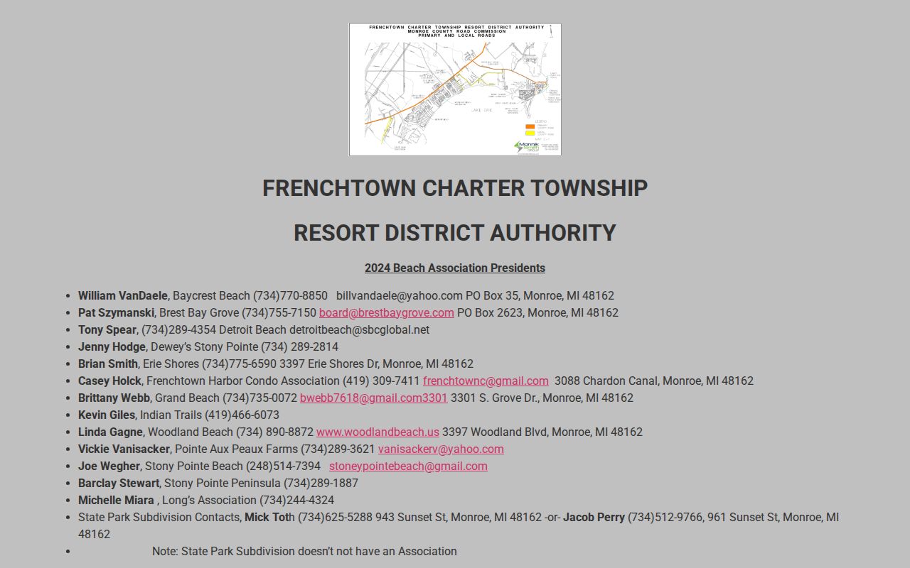
The published inventory is useful for identifying the right community organization, while membership and parcel ownership remain separate questions.
Comparing Frenchtown Township Neighbor Sources
Official records describe a defined relationship: parcel to tax-roll owner, deed to recorded party, or voter file to eligible public registration fields. Commercial neighbor-lookup tools are private compilations of old address, telephone, marketing, and public-record fragments. They can merge similar names, lag behind a move, and do not override state redactions or public-record limits.
| Official record path | Commercial neighbor category |
|---|---|
| Names its custodian, record date, and defined field | May combine sources with unclear dates or matching rules |
| Can be checked with assessor, clerk, court, or recorder | May require a private opt-out or correction process |
| Respects Address Confidentiality and statutory redactions | Cannot supply protected DMV, utility, or ACP information lawfully |
Historical Frenchtown Township Neighbors
For an earlier block, a Polk street section can list residents or businesses in house-number order. A Bresser criss-cross directory is address-first and can show heads of household, phone numbers, owner or renter notation, and move cues where the volume includes them. The Monroe city and county collection is the practical historical gateway, but a Monroe volume is not automatically a complete Frenchtown Township directory. Confirm its coverage note and year.
Ellis Library and Reference Center houses the Monroe County Library System genealogy collection, including city directories, land and plat maps, cemetery work, probate, oral histories, church records, and microfilm. Historic map, directory, and newspaper dates should be paired with the legal description or the printed address. A current postal label may differ from the historic township, Monroe, or Newport wording.
Frenchtown Township Block Geography
Block research changes with the local geography. A Monroe mailing address does not itself mean a parcel lies in the City of Monroe, and northern Frenchtown Township pockets can use the Newport postal route. The county map and the assessor identify the governmental parcel context; USPS confirms where mail is delivered. Keep those answers separate when looking at a street that approaches a municipal line or crosses a postal boundary.
Beach communities such as Stony Point, Woodland Beach, Detroit Beach, Brest Bay Grove, Erie Shores, Grand Beach, Indian Trails, and Pointe Aux Peaux can supply useful subdivision names for map or newspaper research. The Resort District was created under Michigan PA 59 of 1986 and manages district infrastructure such as streets, lighting, drainage assessments, pumping stations, paving, and storm drains. Its public records may help date neighborhood development, but they do not establish a resident list.
For an older block, search the subdivision name with a street name, legal description, and approximate date in the Ellis Library collection or Monroe newspaper microfilm. A change in a postal city, a shoreline address, or a drainage district does not prove that a household moved. Compare the dated directory, deed, or permit with the parcel record before drawing a conclusion about past neighbors.
Note: Record the subdivision name exactly as a map, association, directory, or deed prints it before comparing it with a modern parcel description.
Privacy Limits for Frenchtown Township Neighbors
Public parcel and map records do not reveal utility customers, delivery recipients, every renter, every household member, or protected voters. Michigan’s Address Confidentiality Program gives eligible participants a substitute address and shields their registration application. A blank property or voter search can mean a time gap, a different custodian, a tenant, a child, an unregistered adult, or a protected record. It does not support a conclusion about who is or is not at home.
Lawful use. Frenchtown Township neighbors research is for personal, lawful block context and safety awareness. Public records never allow stalking, harassment, intimidation, or unwanted contact under Michigan law.
Use a narrow request for a needed public record, and contact the local assessor, Clerk, Register of Deeds, or association directly when a source needs correction. Note: Preserve the access date, parcel identifier, and source type so the result can be checked without republishing private details.